News


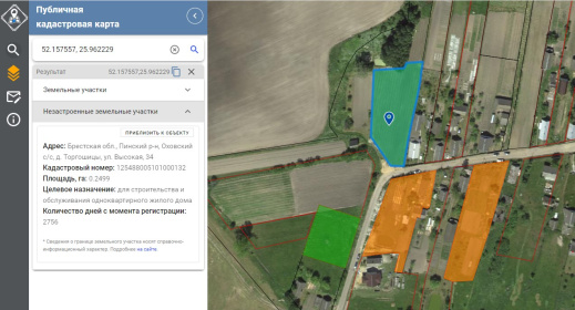
Now on the public cadastral map of Belarus you can find information about undeveloped land plots. The map displays information about registered sites throughout the country, where either objects are already located or can be built with exceeding the standard construction time. Previously, this information was available only for the Brest, Minsk and Mogilev regions.
This new layer on the cadastral map was created to improve control processes and save resources when checking land use throughout the country. It is part of an updated version of the public cadastral map.
The information contained in this layer is actively used by government agencies and organizations to solve various problems related to land accounting, identifying violations and taking appropriate measures.
Thus, the public cadastral map of Belarus becomes a more informative and useful tool for recording and controlling the use of land resources throughout the country.


